This summer is definitely one of the hottest I remember. Not so much in absolute temperatures as in the consecutive number of hot and dry days. Other summers we would have a spell of two hot weeks and then, given that Sofia is at the foot of a high mountain, surrounded by mountains from all sides and with relatively high altitude (600 m), the summer would get wetter and cooler. But not this year. Even in the altitudes above 2000 m it was hot and dry.
Thus our adventure in the Balkan mountains would be remembered as a surprisingly difficult hike in the heat, where we quickly found that we have to ration our water and still sip by sip we finished it some 6 km before any fresh water source and we seriously dehydrated at the end of the hike. Guess what happened yesterday on our latest hike (to be blogged soon, hopefully) - we returned to the car with more than 2 liters of water to spare, we definitely overpacked :), but better safe than sorry.
At the beginning of August we drove to Petrohan mountain pass in the Balkan mountains and walked the trail to Todorini kukli peak - a range of four mountain peaks with small saddles between them.
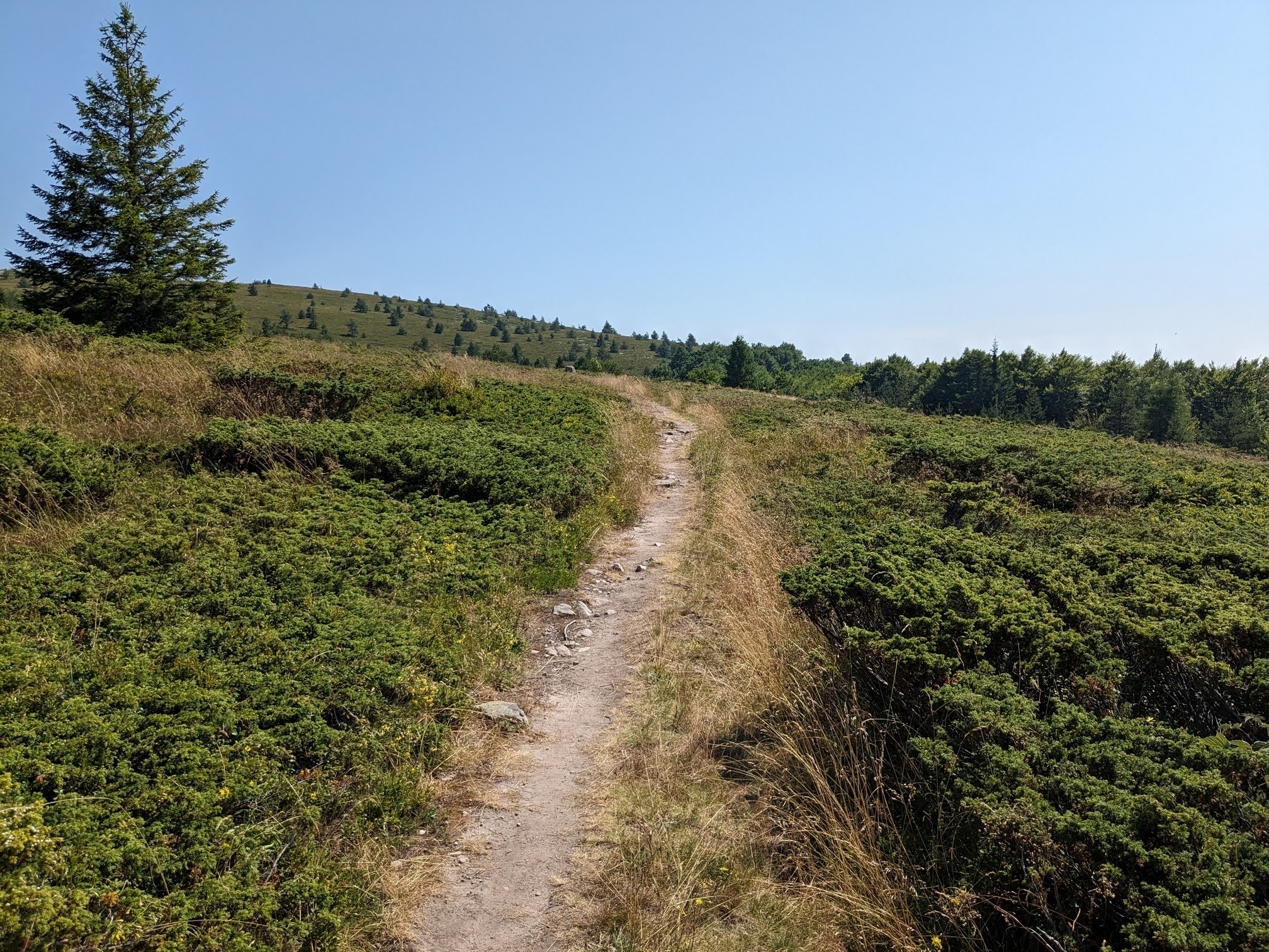
Part of the trail runs along the ridge of the mountain, with views to the north and the south of the Balkans. It's really amazing and cool and this part is fairly easy, with gradual elevation gain.
Unlike Rila and Pirin, the Balkan mountain are greener, with pastures and forests, but with much less rivers, lakes and springs. There were no fresh water sources along the entire trail.
The range of peaks of Todorini kukli
The second of the Todorini kukli peaks. We went up and down and then up again along all four of them
The peaks height starts from 1785 m and gradually descends to 1672 m at their highest points, with saddles, where the altitude drops, so we had to go steep down and then steep up again.
Me-made items, worn on this hike:
Husband: boxers, Grey Burda hoodie
I: lingerie, Sabrina Slims
Hike info:
Destination: Todorini kukli (1785 m)
Mountain: Balkan mountains
Total length: 21 km
Elevation gain: 385 m absolute altitude gain, no idea how much in accumulative altitude gain, a lot
Total duration (plus picnic and rests): 8 hours
Average difficulty: 8 / 10
On the last of the peaks. Here we had our lunch and decided to make the hike circular and explore some trails on the map, that were off the popular track. Given what we know now, I don't think I would recommend that.
The track lead us steeply downhill, and though it was present on the map, the trail was actually only imaginary, along stones and through high grasses, until we reached some forests.. There we found an old trail, that could be fairly easily followed.
After the forest the trail gained quickly all that lost altitude again, so it was as if we climbed the first peak twice, once from the south and then again from the north, along barely discernible paths in the grass, through dwarf mountain pines, until we reached a crossroad with the original trail.
It was an epic adventure and I hope it will teach us never to underestimate the heat, especially along open trails in the summer and always to bring enough water and not to rely on eventual water sources on the way.