Showing posts with label Urvich fortress. Show all posts

Friday, February 14, 2025

Urvich 2025

As planned, this week we travelled to Kokalyane again, but this time we hiked across the road, in the Lozen mountain, around the Urvich fortress.

The day was sunny and even pleasantly warm (6-7 C). Because the gorge of the river Iskar there lies in the shadows of the two mountains, the river was still frozen and the ground was still partly covered with snow.

The path at the beginning of the trail was cleared of debris and fallen trees and easy to walk. I believe this is the path that most visitors to Urvich know and walk and I wouldn't be surprised that a lot of people do not even suspect the existence of other walkable paths around.

After the detour for the monastery, the path seems abandoned, with lots of fallen trees, blocking it and requiring going around. To be honest, it had a very Blair witch vibe today and gave me a bit of the creeps.

Hike info:

Destination: Urvich
Mountain: Lozen
Total length: 6 km
Elevation gain: 90 m
Total duration (plus picnic and rests): 2 h 30 min
Average difficulty: 2.5 / 10


Me-made items, worn on this hike:
 
Husband: men's boxers, Burda cargo pants, Burda longsleeve, Burda hoodie, hat, (scarf in the backpack)

I:  socks, lingerie, Grasser sweater, Central Park hoodie, CC copycat hat, gloves, (scarf in the backpack)

I was just commenting with husband, that there were still no spring flowers on Kokalyane and Urvich and we came upon these snowdrops and hellebores :)

After doing the full circle around the hill and returning back to the river we followed the hidden path along the rocks to the Urvich fortress. We found this path last time we were here and it is probably the most exciting part of the hike.


The excavations of the fortress were closed and covered for the winter season, but the works have gained some progress over the past three years since we were here.


The grounds of the Urvich fortress are now like a museum in the open, with a number of information boards, elucidating the history of the place and the unearthed artifacts. This was definitely the most interesting and informative part of the hike.


After visiting the excavation works we went down and then up the opposite hill to the functioning monastery, where we had our lunch on one of the sunny benches. It was a short but nice hike and I am so glad we chose Urvich for our visit today.


Monday, January 10, 2022

Urvich 2022

After some truly spring-like days mid-week, with temps in the range of 13-15C in Sofia, the eternal pessimists and misanthropes at weather.com forecasted doom and rain on the weekend. Luckily, as it is often the case, they were wrong and Sunday was warm and sunny (for January in Sofia) and we packed our backpacks and went to Urvich - a place in Lozen mountain with the ruins of the medieval fortress Urvich, as well as a functional monastery on the other side of the hill.

:The start of the ecotrail is marked by the memorial of the Construction troops, who paved the road from Sofia to Borovetz during the first half of the last century.

:The river Iskar, which runs between the mountains Plana and Lozen
:The path from the memorial to the detour for the monastery was wide and clear

:However, several years ago there was a big storm in the region and dozens of trees were broken and fell, blocking the path. For some reason, the authorities have decided not to clean the path after the detour for the monastery, so it has been abandoned by tourists and getting wilder and less passable. 

:Of course, that didn't stop us from walking it all the way, closing the circle back to the river. In a way, this was probably the most interesting part of the hike. The trail is circular and there is actually a hidden path uphill that closes the circle and leads to the beginning of the trail. It is amazing how many people visit the place and don't actually know that the trail doesn't stop at the monastery.


:A private villa (?!) built on top of the hill near the ruins
:After making the full circle of the trail we climbed up the path to the excavation works.

:Most of the ruins were covered for the winter, but the works have progressed greatly during the four years we hadn't visited the place and have now reached the citadel on top of the hill


:The place was strategic for the protection of the city of Serdika (now Sofia), as it lies on the only path between the mountains Lozen and Plana.


Me-made items, worn on this hike:
 
Husband: men's boxers, Knip Mode cargo pants, knitted socks, hat, (scarf in the backpack)

I:  socks, lingerie, Copper Cables sweater, CC copycat hat, Borika gloves, (scarf in the backpack)


:The whole hike was up and down, up and down :) After we climbed to the citadel, we went back down to the main trail and then climbed the hill across up to the monastery, where we had our lunch.

Hike info:

Destination: Urvich
Mountain: Lozen
Total length: 7 km
Elevation gain: 90 m
Total duration (plus picnic and rests): 2 h 30 min
Average difficulty: 2.5 / 10

:After our lunch we went down to the main path again and and had almost reached back the river, when we noticed a path up the hill. We decided to follow it and to our amazement it took us up to the fortress and the ruins along an alternative route. This place is so amazing, every time we visit we find something new about it!


Saturday, March 21, 2015

Urvich on the First Day of Spring

When the day is nice and sunny and we want to grab a hike, but don't have much time or aren't prepared for a long journey, we usually choose a couple of routes - Bistritza and Zheleznitza, because we live so nearby Vitosha, or Pancharevo and Urvich - also not very far and easy walks. Not so easy it turned out - there must have been a major storm in the valley as there were dozens and dozens of broken branches and uprooted trees blocking the path and we had to find ways to get around them.
I've always thought there is something enchanted about Urvich - the place of the medieval fortress, situated between three mountains and guarding the road to Sofia. The first couple of times we went to Urvich we actually couldn't find the ruins of the fortress. And today we were in for a new surprise. We always thought that the trail in Urvich is a relatively straight one - curving and meandering, but moving to the direction of Kokalyane. So when we finally got to the end of the path on the bank of the river Iskar and climbed the nearby rock above the river we were shocked to see that right across, so far hidden by the rock, was the fortress of Urvich and the same bridge we crossed at the beginning of the path - we had made a full circle, the trail was circular! The confusing factor is that the trail runs between two hillsides and these continue all the way along the trail - a hill, surrounded by hills from all sides. We returned along the same path and climbed the hill to the archeological site of Urvich - the diggings have been covered for the winter, but there was an information board, which made the whole situation quite clear. Then we went to the monastery on the other side of the hill and had our lunch at a sunny table in the yard of the monastery.

Има нещо странно в Урвич

За четвърти път идваме на разходка в района и пак успяхме да се изненадаме. За днешния слънчев първопролетен ден искахме лесна и бързодостъпна дестинация, затова и избрахме отново Урвич. Паркирахме колата до снажния полугол трудовак и слязохме към реката.


Очаквахме пролетна разходка, но пътеката си беше зимна, на места с доста дебел слой сняг.

До разклонението за манастира беше лесно и разчистено от клони, но след манастира никой не беше минавал от седмици. Явно в района е вилняла сериозна буря - имаше десетки, може би дори стотици повалени дървета, счупени клони, изтръгнати от корен солидни дънери, които препречваха пътеката. Уж лесната ни разходка се превърна в трасиране на нови пътеки в опит да се заобиколят непреодолимите бариери на пътя.


Все пак стигнахме до края - брега на Искър и се изкачихме на хълма със заслона. И друг път сме идвали до заслона, но не сме се качвали на камъните над него. Този път обаче решихме да си изпием кафетата на теферич и гледки - и каква изненада! Срещу нас на отсрещния хълм се виждаше крепостта (по-точно вилата в средновековен стил, която е край руините на крепостта), а долу реката се пресичаше от същия мост, от който започва пътеката. След четири размотавания из околността едва днес осъзнахме, че маршрутът е кръгов и сме се завъртяли обратно до началото на пътеката, но от другата страна на реката. Защо не сме го видяли досега? На това място реката прави завой и скалата влиза директно във водата, не може да се заобиколи покрай нея и да се стигне до моста. От нивото на реката не се вижда мостът, вижда се само реката, която завива покрай скалата. Пътят през цялото време се движи в долината между две отвесни височини и създава усещане за придвижване напред, по посока на Кокаляне. Завъртането става постепенно и е доста дезориентиращо.


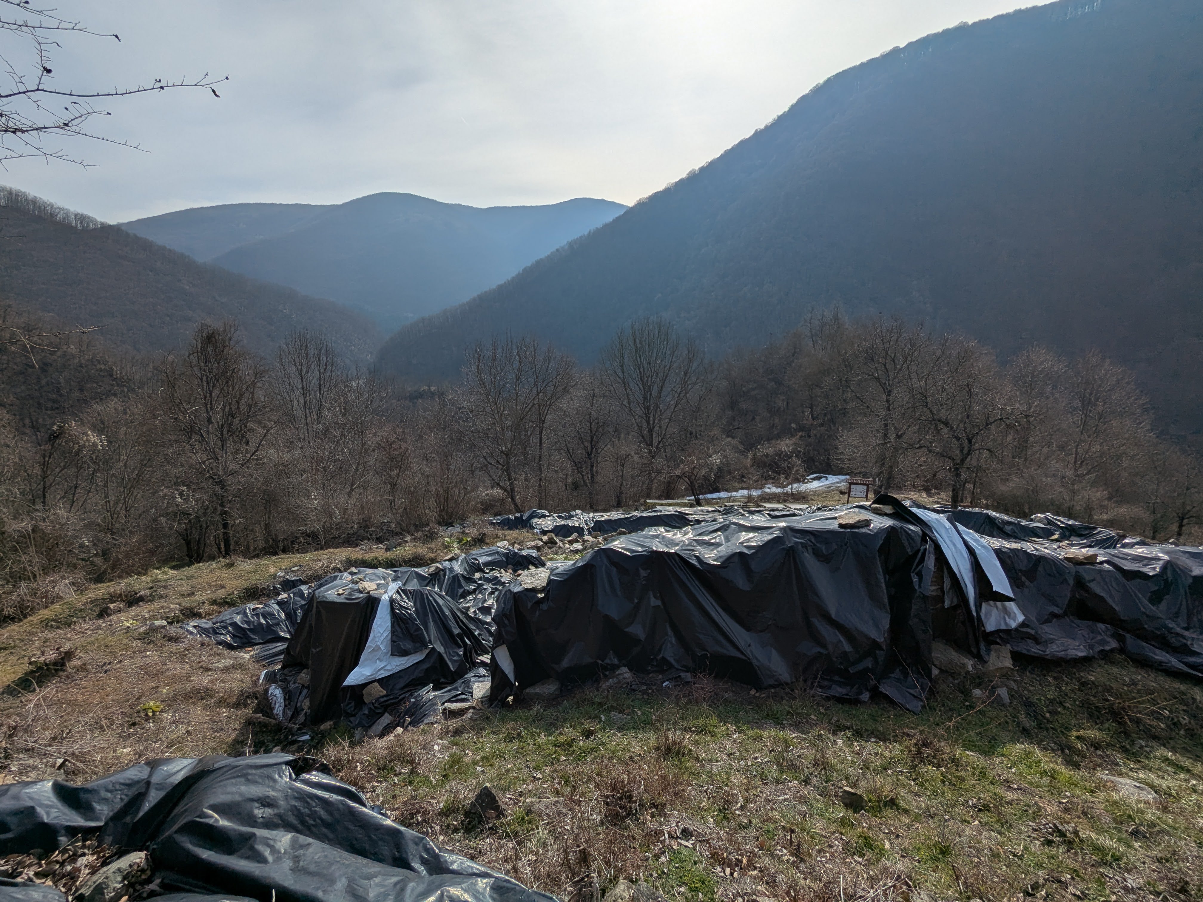
Върнахме се по стъпките си обратно и се изкачихме по хълма до разкопките на крепостта.

Напреднали са доста от последното ни посещение, а най-хубавото - сложили са чудесно информационно табло с карта на района.


Така вече става доста по-ясно къде сме се въртяли досега.

Реставрацията на църквата напредва. Може би ще се опитат да направят нещо подобно на Цари Мали Град, с почти изцяло възстановени постройки.


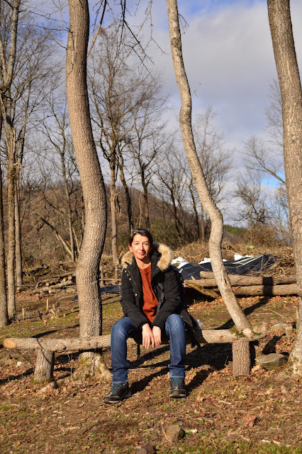
След крепостта се изкачихме и до манастира, където си направихме пикник на една от напечените от слънцето маси.


Поглед към края на пътеката от отсрещната страна. При по-ниски води би могло да се мине по камъните, но днес беше изключено, реката е доста пълноводна и има още да се пълни от топящите се снегове.