Showing posts with label хижа. Show all posts

Sunday, September 1, 2024

Hiking in Greece. Mount Olympus Day Two

The second day of our hike was the real trial - we had planned to climb about 900 m elevation gain up a very steep trail to peak Skala and then eventually to peak Mytikas and then go back all the way back to the parking lot of Prionia.

The sunrise over the Aegean sea, seen from the lodge 2100 m above sea level, with Mytikas at my back, was absolutely breathtaking. It felt so surreal the whole time, that we were in the high mountains and we could see the sea down there.

The trail is really very, very steep all the time and reminded me a bit of Vihren in Pirin.


Gradually we came out of the forest and into the bare stoneland.


Hike info:

Date: 24 August 2024
Destination: peak Mytikas
Mountain: Olympus
Total length: 21 km
Elevation gain: +900 m, -1900 m
Total duration (plus rests and lunch): 11 hours
Average difficulty: 10 / 10 
 

I don't think I've ever seen such bare land. The upper parts of Rila and Pirin are like deserts, but this mountain takes the idea of bare rocks to another level.


Me-made items, worn on this hike:

Husband: boxer shorts, Burda cargo pants
I: lingerie
Gaby: lingerie, Burda T-shirt 
 

There were a couple of wild goats down there, munching on the meager patches of grass, but they were too far away from us and are impossible to see on a phone picture


Finally - peak Skala. Here ends the more or less normal trail and a lot of hikers climb only to Skala. Husband and I had wondered a lot whether to continue to Mytikas, I was almost certain, that I did not want to risk it. However, a talk we had the previous day with a guy, who planned to climb the peak for the second time, reassured us, that it was doable. We had a quick snack on Skala and started preparing for the final climb.

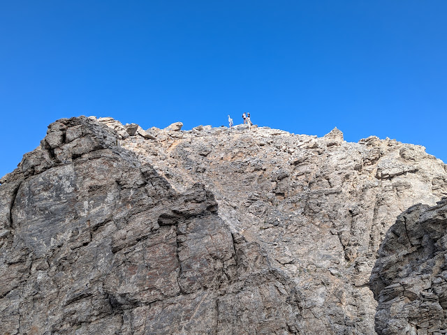
The distance from Skala to Mytikas is only 400 actual meters, but it is very, very dangerous and unsecured. A lot of people risk it, some make it with the help of guides with ropes. One could speculate, that the trail is left unsecured because of the guide business...

The slope is almost vertical, with nothing to grab on, but stones, some of which are loose and other too slippery from many feet, that have stepped on them.

Gaby and her boyfriend were very brave and enthusiastic, but I started having my doubts - so much risk for a few meters higher?


In the end we climbed up to 30 m away from the peak and decided to call it a day and get back to Skala. For me that was more than enough rock climbing and for the future I intend to stick to more normal hiking trails, secured with ropes and poles.

On peak Skala, with Mytikas on the background.

Zeus was there also :)
The way down was much easier, but so steep and so long :)
The provisions caravan
Back at the beginning of the trail

Friday, August 30, 2024

Hiking in Greece. Mount Olympus Day One

Yesterday we came back from our big adventure in Greece. This was our first real hike abroad - we've gone for walks along hills in Greece, but this was a bona fide mountain hike to the highest peak in Greece and the second highest on the Balkans - mt. Mytikas in Olympus mountain.

Husband, Gaby, her boyfriend and I started with the car early from Sofia and arrived at the parking place Prionia around one o'clock. The weather conditions were simply perfect for a hike, the parking was full and the place was buzzing with people of all nationalities.

The first part of the hike starts from Prionia and ends at Refuge A Spilios Agapitos. Although the trail isn't too long, it is really steep - the elevation gain is one kilometer! 

However, probably because of the horses, which are the only transport allowed / possible along this track, the trail is very well secured and reinforced and I did not feel the climbing as too difficult. The path to the Refuge is entirely through a forest and on such a super hot day it felt very shady and pleasant.

Hike info:

Date: 23 August 2024
Destination: Refuge A on Olympus
Mountain: Olympus
Total length: 8.6 km
Elevation gain: 1000 m
Total duration (plus picnic): 3 hours 30 min
Average difficulty: 6 / 10


I'm trying to tempt a finch and a sparrow with crumbs from my banitza :) The finch was very brave, but the sparrow circled me nervously for a couple of minutes, so I pitied it and left the crumbs on the ground :)


Having a well deserved rest. The scary Mytikas is at the center background.


Me-made items, worn on this hike:

Husband: boxer shorts, Burda red T-shirt, Burda cargo pants
I: lingerie, Burda pink T-shirt (at the beginning of the hike)
Gaby: lingerie, Burda navy-blue T-shirt

We arrived at the refuge in the late afternoon, where we had our diner and shelter for the night.The lodge was full with climbers from all over the world (mostly Europe, of course) and it was actually exciting and fun, despite the spartan conditions. A night view to the Aegean sea from the lodge


Friday, July 21, 2017

Two Days in Rila. The Seven Rila Lakes

Husband and I had a mini-break in the Rila mountains this week. We drove to Pionerska Hut and from there hiked up to the Seven Rila lakes, along the ridge of the mountain to Razdela and down the valley of Bistritza river (every third river in Bulgaria seems to be named Bistritza (clear water) :) to Ivan Vazov Hut, where we spent the night.
We hiked to the Seven Rila lakes a few years ago together with a tourist group, organized transport and using the chair lift from Pionerska Hut to Rila Lakes Hut. This time we felt experienced enough to organize the hike by ourselves and to climb the path from Pionerska to the lakes without the help of the chair lift.

Along the path from Pionerska to Rila lakes

Lilium martagon, protected species in Bulgaria

The first lake


7 lakes Hut and the second lake

Husband resting near the third lake
The third lake


The forth lake - The Twins

The fifth lake - the Kidney


The small river, which connects the sixth lake - the Eye with the Twins

The deep blue waters of the Eye - 35 m deep


The Eye - my favourite

On top of the the Lake Peak (2560 m)

The seventh lake - the Tear

The col Razdela, cross point of various tracks in Rila

The picturesque valley Pazardere of river Bistritza, with Ivan Vazov hut in the distant center, peak Otovitza to the right and the Kalin peaks to the left


Sunset over the valley