Showing posts with label Железница. Show all posts

Friday, June 13, 2025

Bistritza - Zeleznitza 2025

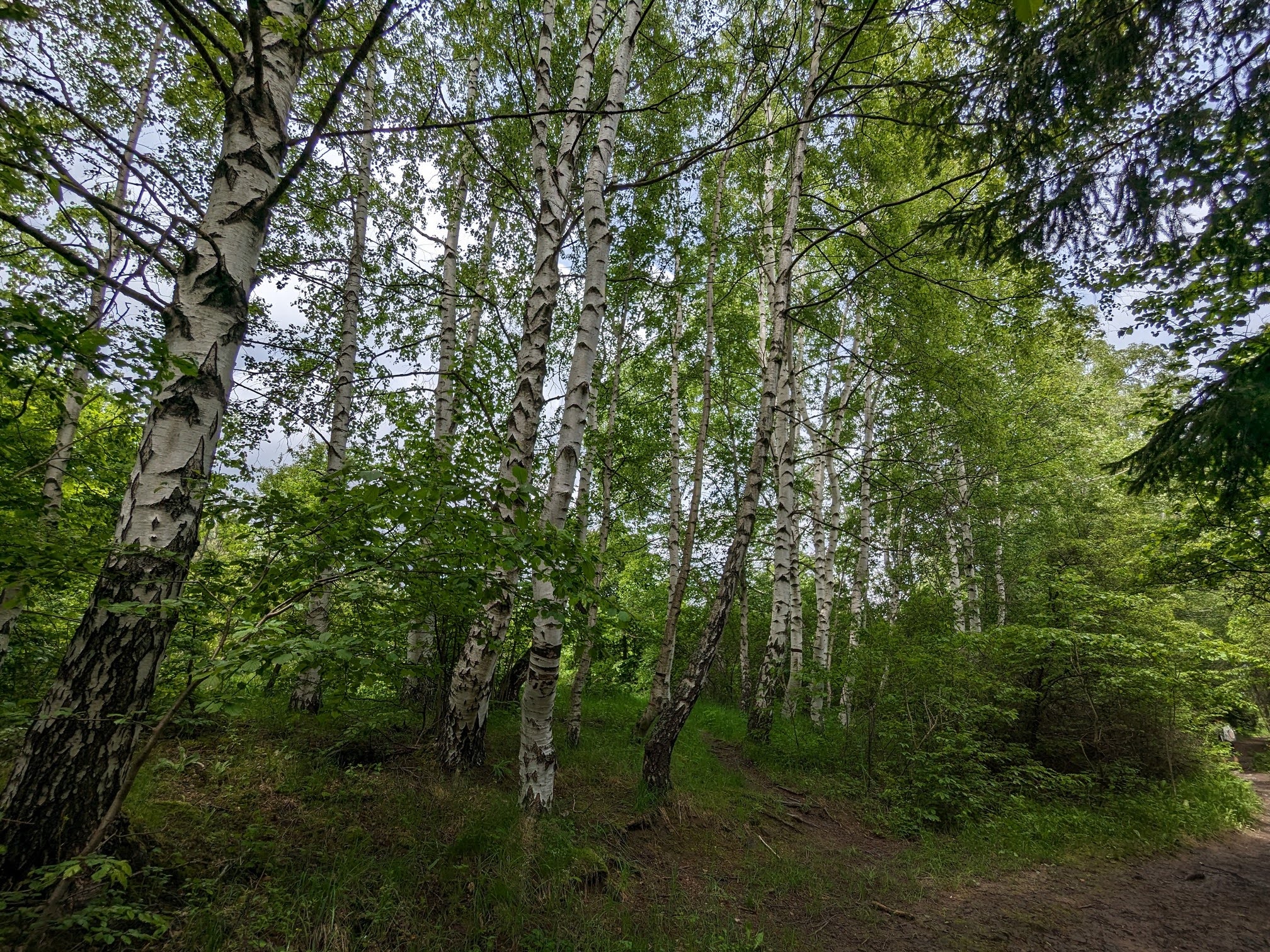
The low altitude circuit trail on Vitosha is at its prime at the end of May and June, when it is in full green mode, with lots of flowers and blooming trees. We love to frequent various parts of it at this time of the year, today we chose the most popular of them all, only some 30 min by car from home - the section between the villages of Bistritza and Zeleznitza and back.

Unlike previous rainy years, June is warm and sunny this year, with just a touch of chill in the air in the low parts of the mountain.


Today we seem to have happened upon the very time of blooming of the elder trees, so the air along the trail was amazingly fragrant. We gathered a bunch of elder flowers and I'm making an elder lemonade right now.

Hike info:

Date:  13 June 2025
Destination: low altitude circuit trail Bistritza - Zeleznitza and back
Mountain: Vitosha
Total length: 12.5 km
Elevation gain: 80 m
Total duration (plus picnic and rests): 3 hours
Average difficulty: 2 / 10

The picnic area around the Selska river above Zeleznitza was packed with children on a school trip, enjoying the simple delights of playing in its shallow waters :)

We found a quieter place up along the river, where we had our delicious picnic.


Me-made items, worn on this hike:

Husband: boxers, Burda t-shirt
I: lingerie, Sabrina Slims I, Burda blouse

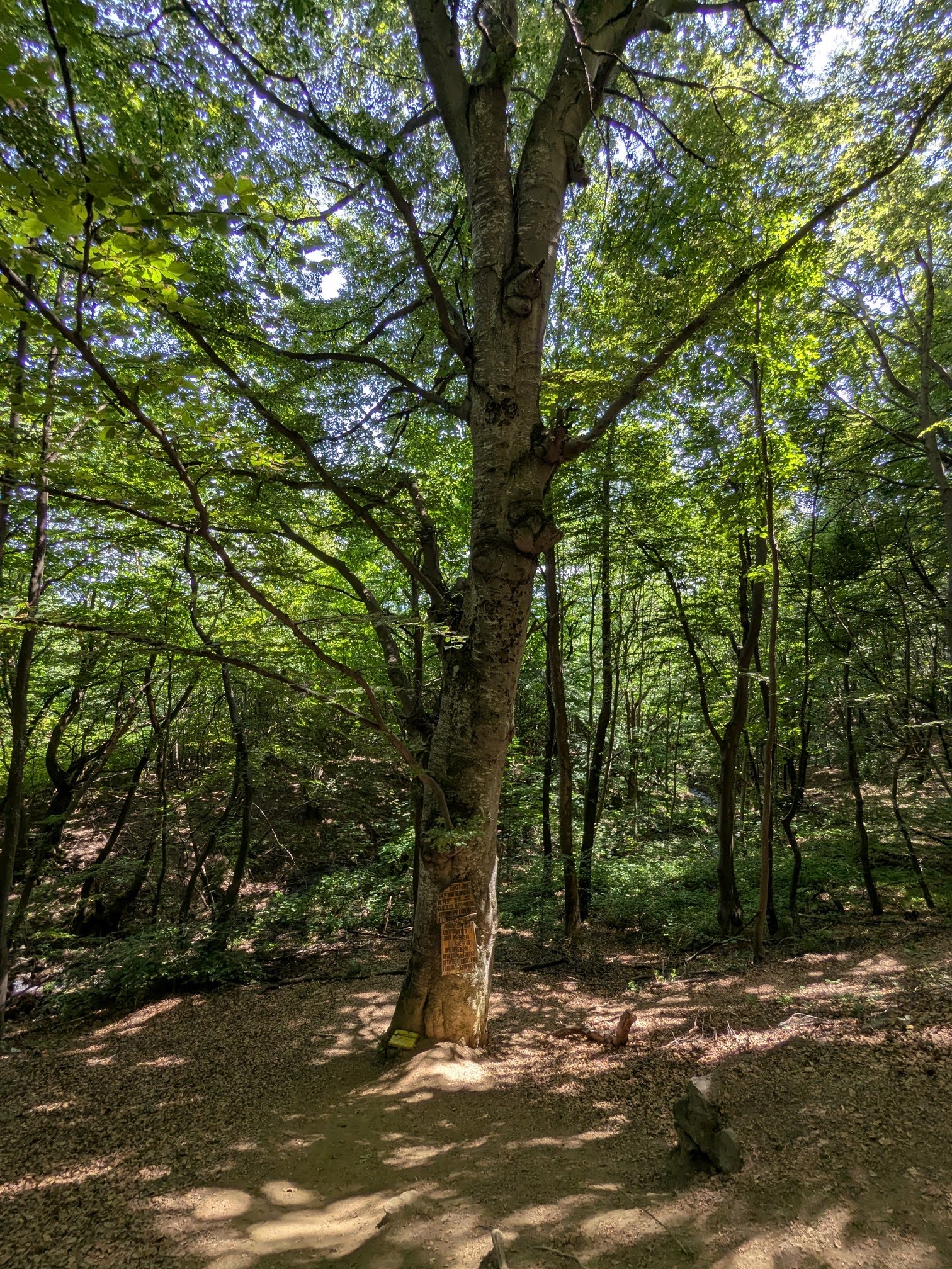
And back along the same track - one of the disadvantages of the low altitude circuit is, that the hikes are usually to and fro, unless they are combined with some climbing and descending, or involve the use of  public transportation. But the trail is so lovely and easy, that walking it in both directions was a delight, not a chore.

An interesting beetle on the path - Morimus funereus, long-horn beetle, буков сечко.


Sunday, June 16, 2024

Zeleznitza - Kupena Hut 2024

It has been 9 years, since we last climbed the trail from the village of Zeleznitza to Kupena hut and back. This is probably one of the steepest trails on Vitosha, with over 800 m elevation gain over less than 6 km. Because of the significant slope, the trail is exhausting in both directions - much more, obviously, up, but the downhill traverse is a killer for the knees and leg muscles. Quite frankly, after yesterday's hike I don't feel an urge to repeat this climb any time soon. No wonder it took us 9 years since the last time :)

Despite the difficulty of the track, it is a fairly popular one, mostly because of its accessibility - the village of Zeleznitza is close to Sofia, with excellent public transport. A lot of the climbers rest at Kupena hut and then continue up ro Cherni vruh - Zeleznitza is one of the starting points of the tracks to the summit. We've done this extreme climb too, but yesterday our aspirations were modest - Kupena hut and back.


Hike info:

Date: 15 June 2024
Destination: Academic hut (1782 m)
Mountain: Vitosha
Total length: 12 km
Elevation gain: 830 m
Total duration: 4 hours
Average difficulty: 6 / 10

Me-made items, worn on this hike:

Husband: boxer shorts, cargo pants, hoodie
I: lingerie, Sabrina Slims, raglan Burda, hoodie

The trail was very green and the meadows were covered with wild flowers. June is probably one of the most beautiful months on Vitosha.


We had our picnic on the grounds of Kupena hut, recovered our strength and took the same trail back to the village and the car.


Tuesday, January 30, 2024

Bistritza - Zeleznitza in January

Our Friday hike was along one of the closest to home and easiest trails, from the village of Bistritza to the village of Zeleznitza and back along the same trail, which is part of the low altitude Vitosha circuit.

However, on a winter day, the path is not so easy, especially after a sequence of sunny days and freezing nights - parts of the trail were covered with melting ice and very difficult to traverse. 

The trail is extremely popular, but on a cold Friday it was almost empty - on our way to Zeleznitza we met with absolutely no one, on the way back we did encounter a couple of other hikers.

A curious anecdote - there are two parking lots at the start of the trail - one at the very end of the village, where we left the car, and one 1 km further along. This further section of the asphalt road has been abandoned and I believe it is closed for cars (theoretically), but people usually drive to the end of it and park their cars at the old parking lot, where the road meets the trail. However, just before the parking lot, one of Bistritza river tributaries had over-flooded a section of the road, it was completely frozen from bank to bank and extremely dangerous for driving. We were so relieved to have left the car at the other parking lot, unfortunately there were cars in the dangerous section and two of them had already had a minor accident, sliding along the ice and bumping into one other.

Hike info:

Destination: low altitude circuit trail Bistritza - Zeleznitza
Mountain: Vitosha
Total length: 13 km
Elevation gain: 80 m
Total duration (plus picnic and rests): 3 and a half hours
Average difficulty: 3 / 10 

Me-made items, worn on this hike:

Husband: boxers, Knipmode cargo pants, hat, socks, scarf
I: lingerie, "Page" hoodie, socks, hat, gloves, scarf


We had our picnic on the sunlit benches by the river and quickly headed back.


I love refreshing winter hikes, when the sun is shining and the air is cold and crisp :)


Sunday, June 11, 2023

Bistritza - Zeleznitza 2023

Although Bulgaria is not a tropical country and rainy season is not a thing here, it is this year. The forecasts for over two months now feature rain and thunderstorms almost every day and hinder our plans for high mountain hikes. So last Saturday we decided to play it safe again and do the Bistritza - Zeleznitza trail and back - a very popular and easy 12 km trail in the low parts of Vitosha.

On summer weekends this trail is usually more densely packed than an alley in a central park, with tourists, bikes and even prams, but due to the rainy weather this Saturday it was almost empty, which made a hu-u-ge difference in our hiking experience. 

As promised, the rain came, but it was only a drizzle, so it was not that much of a hassle. The brunt of the rain coincided with our lunch break in a roofed gazebo, so all in all it was a great exercise, with amazing air freshness.

Hike info:

Destination: low altitude circuit trail Bistritza - Zeleznitza
Mountain: Vitosha
Total length: 12 km
Elevation gain: 80 m
Total duration (plus picnic and rests): 3 hours
Average difficulty: 2 / 10


Me-made items, worn on this hike:

Husband: boxers, Knipmode cargo pants, grey Raglan shirt
I: lingerie, flared leggings, hoodie


Friday, June 10, 2022

Bistritza - Zeleznitza 2022

We've been so busy this last week with some home repairs and improvements, that I had no time for my hobbies and the blog. We even had to cut our Saturday hike to a short and close by destination - the popular Bitritza - Zeleznitza trail and back. 

There is a reason why we rarely hike this so popular trail - it is too crowded, too close to the city and the feeling of detachment from civilization, traffic and people is kind of lost, when there are so many hikers, bikes and even baby prams along the trail.

To compensate for the levelness of the trail and because of our shortage of spare time, we umped our hiking speed and in the end were quite exhausted, but satisfied with the exercise. The weather was lovely, not too hot, the scenery - still freshly green, so all in all - it was a nice hike. However, I doubt we'll choose Bitritza - Zeleznitza any time soon.

Hike info:

Destination: low altitude circuit trail Bistritza - Zeleznitza
Mountain: Vitosha
Total length: 12 km
Elevation gain: 80 m
Total duration (plus picnic and rests): 3 hours
Average difficulty: 2 / 10 


:We had our lunch here, right by the Selska river.

Me-made items, worn on this hike:

Husband: boxers, Knipmode cargo pants
I: lingerie, Burda Henley t-shirt, Sabrina Slims, hoodie in the backpack