Showing posts with label Конярника. Show all posts

Monday, July 28, 2025

Peak Selimitza, Vitosha 2025

On one of the hottest days of the year husband and I decided to hike high up on the plateau in the open and in the sun, instead of staying put at home, as normal people do. Crazy, right :)

We started fairly early, but it was one of those days, with equatorial nights, that were hot right from sunrise, even above the 2000 m line. Well, of course, the temperatures there were in the 20-ies, not in the 40-ies degrees, as down in the city.

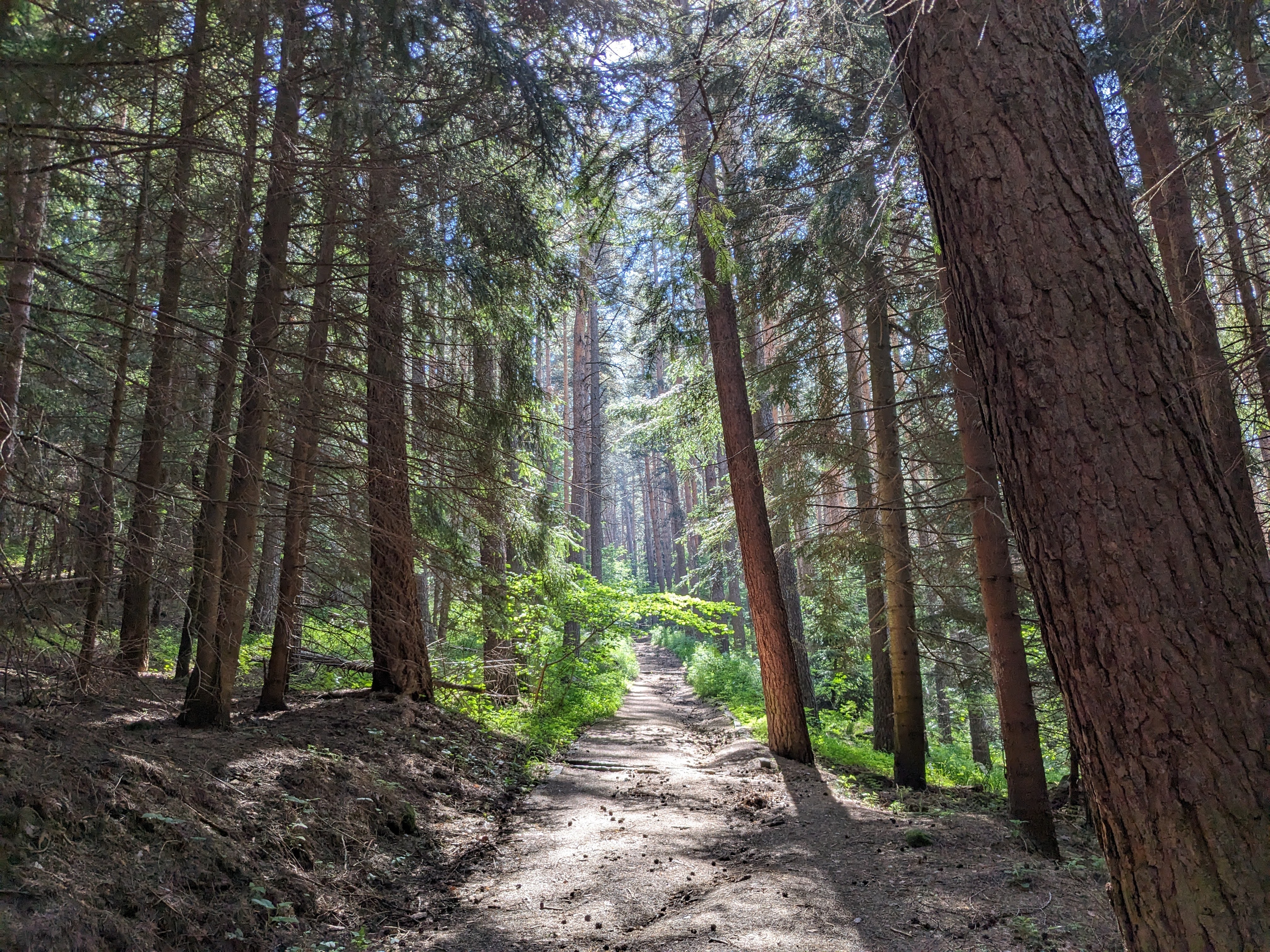
We started from Zlatnite mostove in the direction of Kumata hut, where we refilled our water bottles and some additional water containers for the hike - bitter experience has taught us to carry excess water rather than risk dehydration during hikes on hot July days.


Konyarnika - the place is practically a raspberry garden, alas it's still early - the raspberries need a couple of weeks or so to ripen.


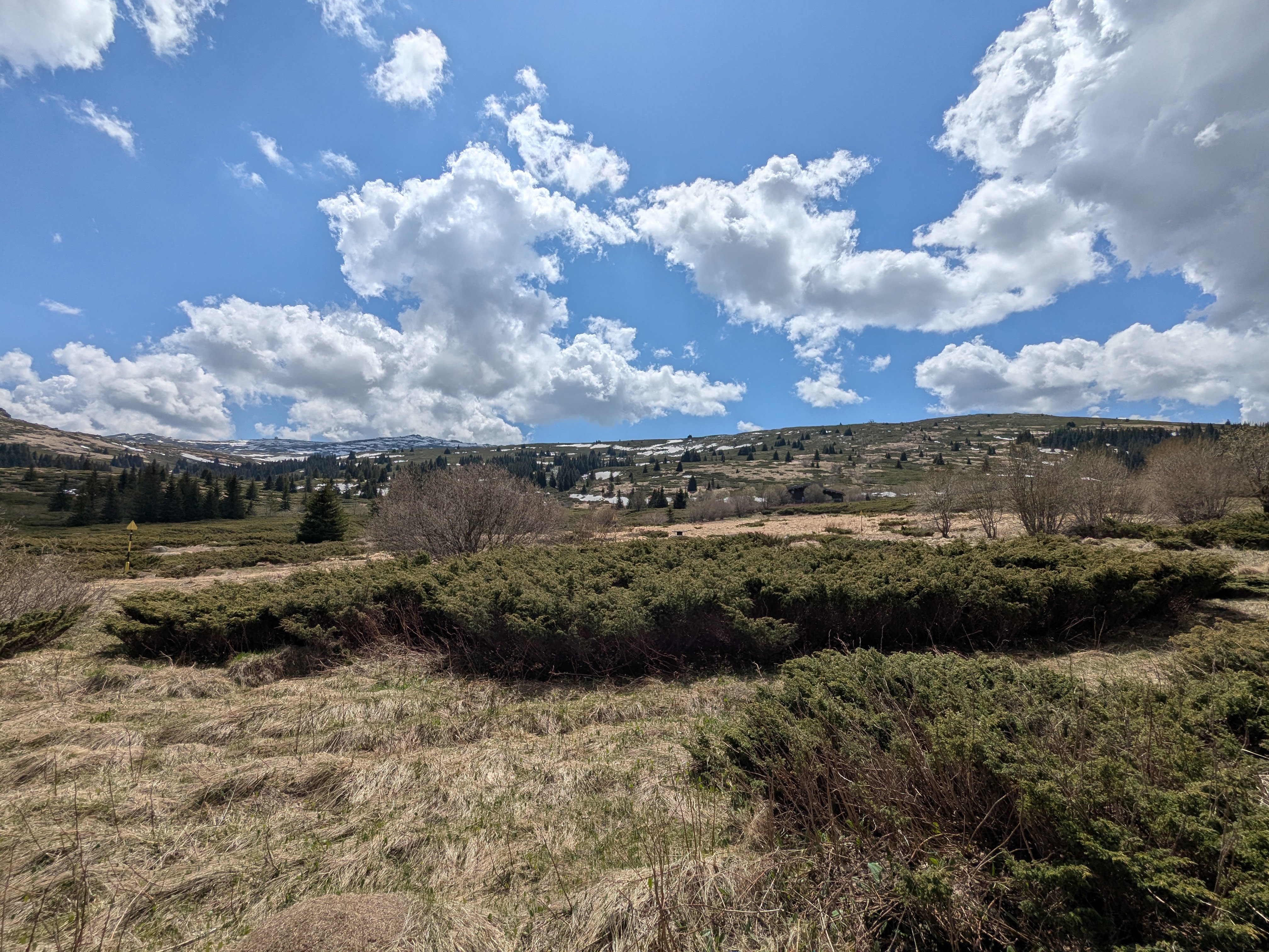
The plateau - my favourite part of this trail, with a glimpse to Ushite and Kamen del from a different point of view


Hike info:

Destination: peak Selimitza (2041 m)
Mountain: Vitosha
Total length: 17 km
Elevation gain: 650 m
Total duration (plus picnic and rests): 5 hours
Average difficulty: 6 / 10 


Peak Samara and Cherni vruh in the distance
Our destination - peak Selimitza. Surprise, surprise - a pile of rocks :)

This is our second climb of Selimitza, one of Vitosha's dozen. The day was hot, the peak is a bit aside from the popular tracks, so it was no wonder, that we were the only ones around for miles :)


Me-made items, worn on this hike:
 
Husband: men's boxers, green Burda T-shirt, orange Burda T-shirt
I: lingerie, Burda blouse (mostly in the backpack), Burda shorts

Although it is probably the lowest of the Vitosha's dozen peaks above 2000 m, it is one of the most panoramic, with views in all directions, stretching from the Balkans to Rila and Pirin.

We had our lunch directly on the stones under the sun, cooled by the constant breeze on the top, enjoying our cold(ish) beers and the vast views.

On the way down we took the long and winding trail through huts Zvezditza and Edelweiss to Zlatnite mostove.


Friday, April 25, 2025

Solo Hike to Konyarnika 2025

Husband has an exam on Sunday and is using his free time to prepare for it (or at least that's the plan). My Friday however was free and the weather was fine, the last sunny weather before the expected cold and rain, so I decided to go solo. During our hikes we've met hundreds of people, hiking alone, but I've always found, that having a company is much more pleasurable to me. I don't mind solo city walks, but I almost never hike alone in the mountains - last time must have been 20 years ago. 

I didn't want to risk a difficult and long trail, so I chose a well trodden path - from Zlatnite mostove to Kumata hut, peak Konyarnika and back along an alternative trail by a couple of other huts.

Hut Kumata - because it is a work day, the usually well frequented hut and the trail to it were empty.

Down in the city it was sunny and short-sleeve-weather, but up above the 1500 m line it is still late winter - early spring, with patches of snow and purple crocuses.
Hike info:

Date: 25 April 2025
Destination: peak Konyarnika (1782 m)
Mountain: Vitosha
Total length: 9.5 km
Elevation gain: 400 m
Total duration: 3 hours
Average difficulty: 3 / 10

Konyarnika - one of my favorite places on Vitosha.

A selfie with Cherni Vruh in the far distance

Me-made items, worn on this hike:

I: lingerie, Burda raglan blouse, Sinclair Journey zippered Sweater

From Konyarnika I took the path down to Zvezditza and Edelweiss Huts

More crocuses

I had my snack at hut Zvezditza and from there continued down the trail to Zlatnite.
February daphne, обикновено бясно дърво, тилилей - може да се каже, че съм била в гори тилилейски :)


Sunday, June 9, 2024

Konyarnika 2024

Yesterday, we hiked another loop trail on Vitosha that we had mapped out in advance. We started from Zlatnite Mostove, taking a new-to-us path to Hotel Boeritza. From there, we continued to Kumata Hut, then to Peak Konyarnika, and back to Zlatnite Mostove, passing by a few other huts. It was a very pleasant and fairly easy hike, despite the significant altitude gain.


The day was unusually hot for early June. In fact, one of the hallmarks of this year's weather has been the label "unusually hot." Coincidentally, the annual mountain run on Vitosha was held on the same day and along the very trail we had chosen to hike. So, on our way up, we constantly passed by runners going down, which was kind of fun.


The trail took us up to Mountaineer's Song Hut

and then to Hotel Boeritza, two places on Vitosha we hadn't visited until yesterday.
Konyarnika is one of my favorite spots on Vitosha. I love the vastness of the meadows and the sense of space there.


Hike info:

Destination: peak Konyarnika (1782 m)
Mountain: Vitosha
Total length: 13 km
Elevation gain: 400 m
Total duration: 3 and a half hours
Average difficulty: 3.5 / 10

Peak Konyarnika was the highest point of our hike, and we decided to have our picnic there, on the stones of the peak.

Me-made items, worn on this hike:

Husband: boxer shorts, cargo pants, hoodie in the backpack
I: lingerie, Sabrina Slims, buttoned Rhapsody, hoodie in the backpack


From Konyarnika on our trail continued downward, by Edelweiss hut and Ostritza hut.


Parallel bars in the wilderness. Some mysteries of the Universe are too good to be missed, so husband had to pay his respects to the random sports equipment in the shrubbery :)


Saturday, September 9, 2023

Selimitza and Samara

A glorious hike we did on the first day of September. The day started sunny in the city, but got quite cloudy and even chilly once we reached the plateau.

We started from Zlatnite mostove, along the well marked and fairly popular trail through Kumata hut, Koniarnika, along the plateau to Cherni vruh. However, our destination point this time was not Cherni vruh, but another peak, one of Vitosha's dozen of peaks above 2000 m altitude - Selimitza.


Me-made items, worn on this hike:

Husband: boxers, Knipmode cargo pants
I: lingerie, Sabrina Slims I, raglan Burda blouse, hoodie


The trail climbs gradually and reaches the plateau, where it stays almost level for a couple of kilometers. The landscape is really fascinating there - the grassy alpine meadows, surrounded by stone peaks.

 Hike info:

Destination: peak Selimitza (2041 m) and peak Samara (2103 m)
Mountain: Vitosha
Total length: 16 km
Elevation gain: 725 m
Total duration (plus picnic and rests): 7 hours
Average difficulty: 5 / 10 

On peak Selimitza (2041 m). Here we had a quick lunch, as we were losing rapidly heat in the cold. The sun was still strong and when it managed to break through the clouds, the air quickly warmed up, but unfortunately while we were around Selimitza, the cover of clouds stayed above our heads almost the whole time.
A view from Selimitza towards Cherni vruh and Samara
A glimpse to the south with dam Studena

On our way back we decided to climb one more peak of the dozen, that was almost on our way - Samara (2103 m). Here the clouds moved away a little and we managed to warm up. There were plenty of blueberries and cranberries at the foot of the peak and we gathered a small box. I made blueberry pie out of them and it was unbelievably tasty! 


There were very few people along the trails on the plateau and it felt like such an adventure, climbing these rarely visited peaks.
On the way back we came upon raspberry bushes with plenty of last ripe raspberries, so now we have 6 more small jars with raspberry jam :)